In remote northwestern Greenland, researchers fought against blizzards, wind storms, freezing weather, fractured ice, logistics difficulties, and time to retrieve an incredibly valuable specimen: 7.4 meters of bedrock and sediment from beneath the Greenland Ice Sheet.
To reach this bedrock at Prudhoe Dome during the 2023 field season, they had to drill 509 meters through ice, and faced numerous challenges—including a fracture that opened up during drilling, threatening the entire project.
However, the team was able to overcome these difficulties and succeed in what they describe as a “photo finish” to finish extracting the core just as time came to pack up.
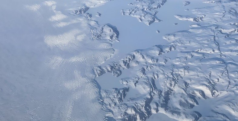
The GreenDrill project is a multi-year, multi-million dollar effort to learn more about the bedrock beneath the Greenland Ice Sheet. This rock contains incredibly valuable information about how the ice sheet has responded to climatic changes in the past, which can also tell us how the ice sheet—covering 1.7 million square kilometers, or 80 per cent, of Greenland—might respond to our warming climate.
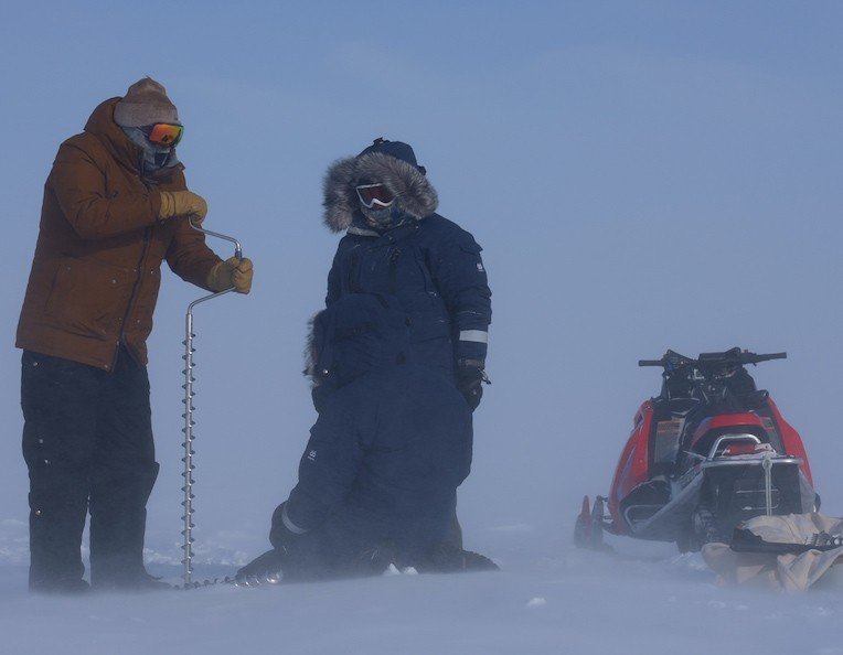
Handrills are used to help set the small explosives in the ice. (Photo: The Green Drill Project)
The top questions on the researchers’ minds involved the potential for the Greenland Ice Sheet to melt, including how much and how quickly, and what this would mean for global sea level rise. With some estimates saying the Ice Sheet could hold enough ice to raise global sea level by 7 meters or more, it’s no surprise scientists want to learn more.
Ice core sampling—where scientists drill ice and analyze the ice, air bubbles, and other contents within— is more common, and this project is only the third time bedrock under the Greenland Ice Sheet has been sampled and studied. After collecting the samples in 2023—which represent the longest rock core that has been retrieved from under the ice sheet—scientists began analyzing these precious samples to see what they could learn about the past and prepare for the future.
Once samples are collected, scientists bring them to labs for analysis, where they can examine the chemical signatures they find in each one to learn more about the ice sheet and its past. When analyzing ice, they often focus on bubbles of air trapped within, along with other discoveries such as volcanic ash. When analyzing rocks, they look for cosmogenic nuclides which provide information about when the rock was exposed to the air and sun and can provide an indication of whether or not the ice covering the bedrock has melted at some point in the past.
“Cosmogenic nuclides labs are basically interviewing rocks and asking the question ‘When have you been last exposed to the open sky and for how long?’” says Joerg Schaefer, geochemist at Lamont Doherty Earth Observatory of Columbia University and co-lead investigator for GreenDrill, along with Jason Briner at the University at Buffalo. Other key collaborators include University at Buffalo PhD student Caleb Walcott and Allie Balter-Kennedy, a former PhD student who finished her dissertation just before the field season began.
“We were expecting that we would get the answer that the rock, of course, had not been exposed any time in the recent geological past...So we were kind of shocked, to be honest, when we got the data back.”
Joerg Schaefer
Recently Nature reported on some of the preliminary findings from the GreenDrill project. According to the researchers’ analysis of the samples, they believe that, at some point over the past three million years, bedrock samples they examined had been in contact with air—meaning at some point the ice sheet melted.
The radioactive isotopes they detected in the samples revealed high levels of beryllium-10, which are an indication the bedrock had once been exposed to air and cosmic rays. The levels they found show the samples were likely exposed to air for around 40,000 years altogether, though it is unknown whether this occurred during a single period of time or whether it was a total of 40,000 years tallied up from multiple events. According to Schaefer, they believe the bedrock was “exposed for quite a substantial time in the recent geological past.”
The scientists also noted that if the Prudhoe Dome site melted, it could could lead to 19 to 73 centimeters of sea level rise around the globe.[1] However, they are in the process of conducting further analysis, and these findings are preliminary for now.
Schaefer says the idea for the GreenDrill project came about after Schaefer, Briner, and colleagues published a paper in Nature in 2016 analyzing samples collected from the thickest part of the Greenland Ice Sheet in the 1990s. These samples, which were obtained as part of the GIST2 project, included 3 kilometers of ice core that was collected over several years.
These ice samples—along a bedrock core that was also retrieved by GIST2 scientists—provided around 100,000 years of climate records. Analyzing this material, the scientists found the bedrock contained cosmogenic nuclides, meaning that at one point the sample of bedrock had been exposed to the sun—which would require it to be ice-free.
These findings came as a great surprise to Schaefer and his colleagues.
“We were expecting that we would get the answer that the rock, of course, had not been exposed any time in the recent geological past because you had 3 kilometers of ice on top,” Schaefer says. “We did not expect that the Greenland Ice Sheet was so unstable that it would deglaciate. So we were kind of shocked, to be honest, when we got the data back.”
After publishing those findings in 2016, Schaefer and his colleagues began to put together a proposal for another project to delve even deeper into the ice sheet’s past. They wanted to learn more about its stability, so they developed a plan to drill into the bedrock and collect more samples. The idea for GreenDrill was born.
“We wrote a proposal saying it’s horrifying we know that the Greenland [Ice Sheet] was not stable… so now we need to really know how this actually happened, when this actually happened, and how vulnerable the different segments of the Greenland Ice Sheet are.”
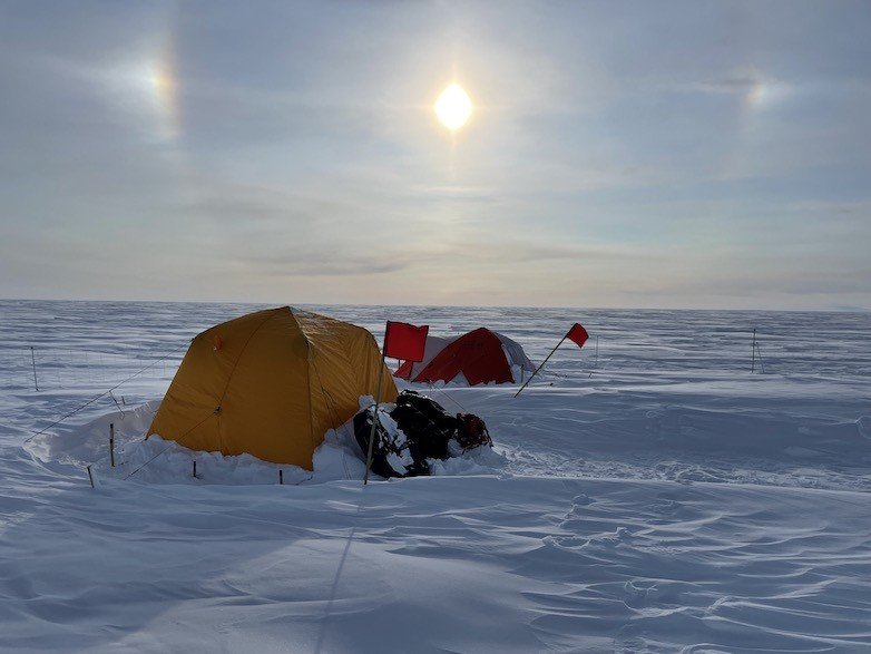
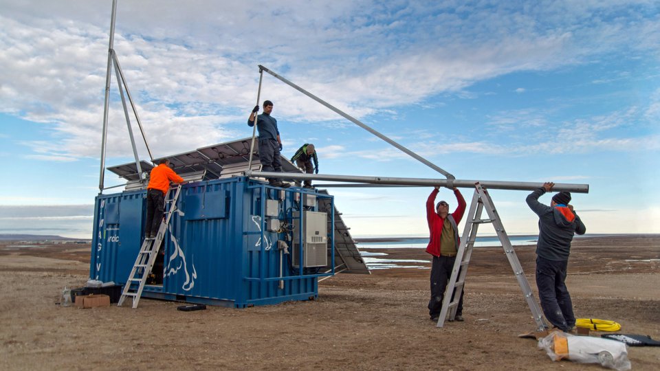
Tents are set up with flags marking their location in case of storm. (Photo: The Green Drill Project)
Over several years, Schaefer and colleagues prepared for this investigation, painstakingly planning the GreenDrill project. In June 2023, team members were able to use the Agile Sub-Ice Geological (ASIG) Drill to drill 509 meters through the ice. Once they reached the bedrock, they were able to collect 7.4 meters of frozen bedrock and sediment from Prudhoe Dome in northwestern Greenland, which they then brought back to the lab for analysis.
The GreenDrill project involves four different locations in northern Greenland, with researchers at each site using a transect with three places to collect bedrock. Two of these spots are on the ice sheet itself, while the other one is on ice-free land located between the edge of the ice sheet and the ocean.
“You can think about drilling through this ice almost as a biopsy,” Schaefer says. “We take a biopsy sample of the bedrock and that really gives us this information about how stable that section of the Greenland Ice Sheet has been.”
He uses another medical analogy to describe how the scientists are using the samples they collect to learn more about different regions and put together an assessment of the ice sheet’s health based on what they find. He says they don’t know which places could cause the most problems, so they need to collect more data.
“Overall, you can think of that as a sick patient and you really don’t know which organ is in worse shape and is the most vulnerable,” Schaefer says. “So we have to test these organs by going around different zones of the Greenland Ice Sheet.”
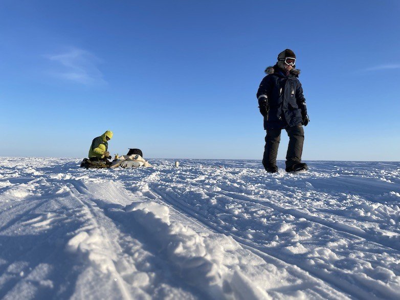
Team member setting up the seismics for ice testing. (Photo: The Green Drill Project)
Building on previous work and looking ahead
The multi-year GreenDrill project was funded by the National Science Foundation, and collaborators include Lamont-Doherty Earth Observatory, University at Buffalo, University of Massachusetts Amherst, and Penn State. The project utilized resources from the U.S. Ice Drilling Program, which conducts fieldwork in the Arctic, Antarctic, and beyond.
The program focuses on drilling ice core samples (and sometimes the bedrock and sediment underneath) to provide information about the past. During the 2023 Arctic field season, the U.S. Ice Drilling Program was involved in projects in British Columbia, Greenland, and beyond. This year, several projects are underway, including analyzing an ice core from Greenland’s Summit, exploring Alaska’s Arctic Coastal Plain, and more.
Over the years, scientists from around the world have engaged in several projects to explore and map the Greenland Ice Sheet in a variety of locations, including the top of the ice sheet. Some of these projects include the Greenland Ice Sheet Project (GISP2), NorthGRIP, and EastGRIP.
The preliminary findings from GreenDrill build on previous work and align with what scientists have learned in the past. The 1993 GISP2 drilling project examined a central Greenland site, which was found to be ice-free at some point during the last 2.6 million years, and a core retrieved from northwest Greenland in 1966 also showed evidence that the site was without ice at some point around 400,000 years ago.
This summer, the researchers will be traveling to northern Greenland to continue the field work and learn more about the Greenland Ice Sheet’s past, which they hope can be used to learn more about what might happen in the future.
After a successful field season, Schaefer is optimistic that this year’s sample collection will be even smoother, after gaining so much knowledge last year.
“We are very much hoping that that learning curve that we had lived through will help us a lot in making a much smoother drilling season,” Schaefer says. “We are definitely expecting now that we will be getting these bedrock samples [with the] ASIG drill and the team has shown it is possible, so we are very much hoping we can show it again and also smooth out the process.”