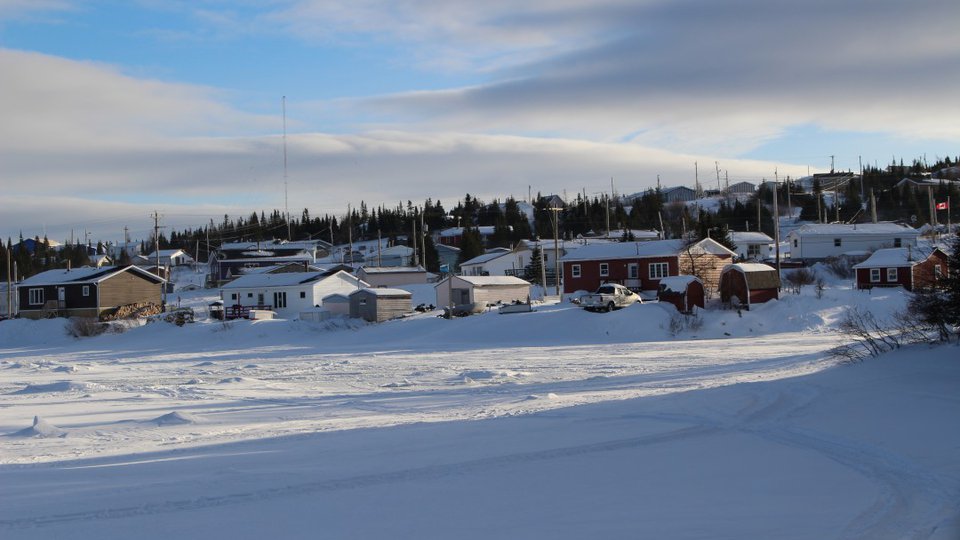
In September 2022, the remnants of Typhoon Merbok slammed into coastal Alaskan communities, leaving buildings floating off their foundations, fuel tanks spilled, power lines toppled, and ground eroded. In Chevak—a city of approximately 950 people—two meters of water roared through low-lying areas, destroying 90 percent of the community’s boats and other vital subsistence equipment.
Chevak is located up the Chevak River, 17 miles from the Bering Sea. While Chevak itself is located high on a bluff out of the floodplain, boats and other vital equipment were stored in the lowland, and forecasters did not have enough information to issue a warning for people to move their equipment.
Devastatingly, the storm destroyed 90 percent of the community’s boats—vital for subsistence fishing and hunting—as well as drying fish, fishing gear, and other food and equipment. Half the community also lost power for three days, which led to a winter’s worth of harvested food—such as fish, moose, and seal meat—thawing out and rotting.
“It can be this one-two punch where your food gets taken away—either washed away or from power outages—and your means of getting food is also taken away. And that’s, of course, extremely challenging and devastating,” says Richard Buzard, geologist and researcher for the U.S. Geological Survey.
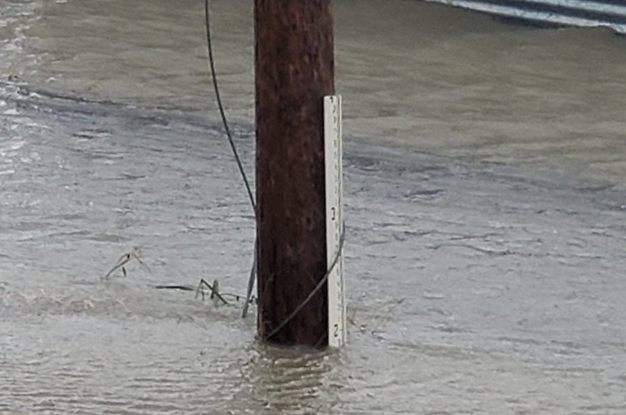
Kotlik Storm Merbok September 17, 2022~. Water at 1.8ft–above boardwalk. (DGGS)
Buzard and colleagues recently published a study in Scientific Reports entitled “Current and projected flood exposure for Alaska coastal communities.” Buzard and his colleagues studied 46 coastal Alaskan communities, where many small Alaska Native villages are located. They put together a database focusing on coastal flooding that incorporates written accounts of floods, observations and remote sensing to learn more about record flood events. They also estimated current and projected future flood risk while incorporating sea level rise projections. They found that 22 percent of structures are currently within the record floodplain area. However, with expected sea level rise by the year 2100, 30-37 percent of these structures would be in the flood zone, depending on the global mean sea level rise scenario (half a meter versus a meter in rise).
“This is an area that historically has been rather understudied and also under-instrumented...”
While parts of the Pacific – such as where Typhoon Merbok formed – have generally been too cold for regular typhoons in the past, that is changing as record-high water temperatures create more powerful typhoons. When winter storms hit Alaska’s coast, they are usually buffered by protective sea ice, but the remnants of Merbok hit before the sea ice formed.
Coastal flooding in Alaska isn’t new. Major flooding has hit some of these communities within the last 50-100 years, but in many areas, “they still do not have a mapped floodplain or estimated record flood elevation to guide safer development,” the study authors wrote.
With climate change and projected sea level rise, the flood hazards for coastal communities are expected to get even worse. To study these topics in more depth, researchers need more data about where the 100-year floodplain or record floods would impact so they can plan development. In many remote communities, this data is lacking.
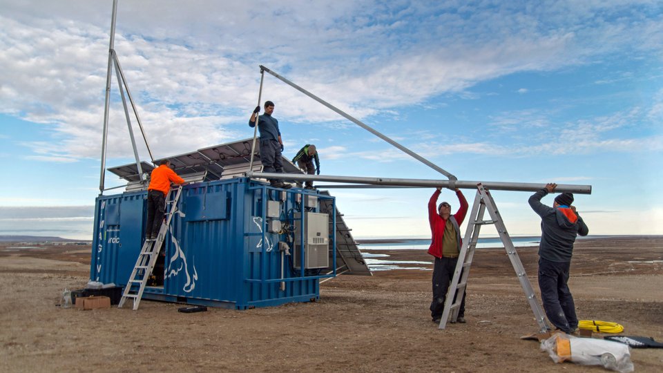
“This is an area that historically has been rather understudied and also under-instrumented,” Buzard says. “There are only two active water level sensors that have been around for a long time across this whole area that’s a greater coastline than California. That’s made things pretty challenging for our type of work.”
Many factors influenced the location of communities near floodplains, with one of the primary drivers being access to food.
“In general, these are communities of primarily Alaska Native peoples who [practice] a lot of subsistence culture,” Buzard says. “It’s fishing, it’s hunting, it’s going around all over the place in boats and on four-wheelers. Being next to the water is vital.”
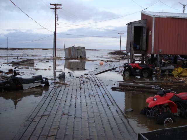
Flooded property on the fully inundated tundra. (Carin Finch/DGGS)
However, the reasons why some communities are located within these floodplains also reflect historic inequality. The study quotes the U.S. Government Accountability Office, saying, “In many cases, Native villages occupy their current precarious locations because the federal government built schools in what were seasonal encampments and mandated that Alaska Native children attend those schools.”
While some communities have relocated away from flood and erosion hazards, many are now far too large to move. Systemic obstacles make it very difficult for tiny rural communities to obtain government assistance with these efforts, and mitigation funds also have barriers, such as cost-sharing arrangements.
Planning for the unique needs of isolated coastal communities
Planning communities with flood hazards in mind is especially important in rural Alaska, which has different planning considerations than a larger and more connected area might. In rural Alaska, many small remote communities also lack infrastructure redundancy, meaning they rely solely on one power plant, water treatment system, or a single road. In a situation where a power plant or water treatment system fails, residents could face life-threatening danger in subzero conditions.
"The decisions we make today about how we address these issues and where we develop are going to ripple through generations."
Many communities in rural Alaska aren’t accessible by road, and boats are how people get around and obtain their food. When Chevak residents lost their boats — along with sheds full of equipment, like life jackets, tackle, and gasoline — they also lost their means of fishing and hunting.
“The majority of the boats in the village were destroyed by the storm, and this is a big deal,” Buzard says. “These boats are everything—this is a subsistence community. The boats are used for fishing, hunting, going up and downriver and travelling to neighbouring communities. And for many people, it might be their only vehicle… just a boat and four-wheeler is what people often use to get around. To lose that is not trivial.”
The study authors note boats are rarely insured in the region, and the cost to replace a boat, including the pricey shipping on a barge, is around $20,000—an extremely high cost in a community with a median household income below $38,000 per year. It also would likely take many months for a shipment to even arrive on a barge.
Local observations: A critical tool in flood mapping
The researchers used local observations, including written accounts and observations, as a key part of their research, which helped them estimate which places are good places to build infrastructure, as well as the spots to avoid due to current and projected future flood risk.
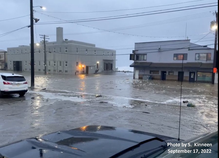
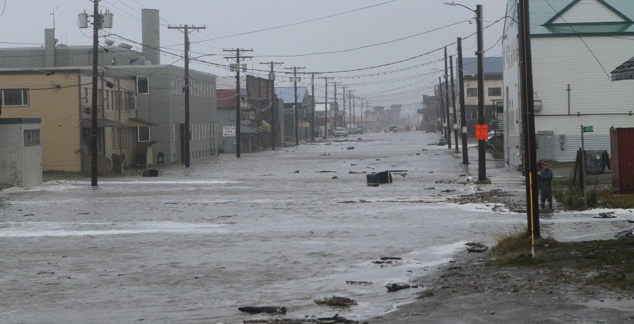
Coastal flood water and debris crossing Front Street in Nome, Ak during Typhoon Merbok. (S. Kinneen/DGGS)
“This is driven by community flood observations, and we continue to rely on them and we’ve found that by using observations from community members we believe it’s helping give a voice and pay more attention to the needs and desires of the communities,” Buzard says. He encourages local residents to share their flood observations, including sharing information on the Alaska Flood Observations Facebook page.
The research was also meant to fill the gaps in data since it has been difficult to compare risks between communities when different data has been collected in each area over the years, with some places having vastly more data than others.
“For the most part, the self-reporting is fairly accurate,” Buzard says, though he notes the lack of a standard data set means it can be difficult to compare communities to one another. “This research is designed to give more of a voice to the quieter communities and give a better understanding of regional flood hazards.”
This type of modelling is vital because it helps communities work together to use this knowledge to guide future development and steer growth into less hazardous areas. This helps boost climate resilience and planning for future site locations.
“We can’t make the same mistakes again because it clearly has a long-lasting impact in 50 years, 100 years, or more,” Buzard says. “The decisions we make today about how we address these issues and where we develop are going to ripple through generations. It’s very important to consider, and a big part of that is recognizing the voice and the observations from the residents of these communities.”