September 24, 2026
In the mid-19th century, the great maritime powers were pursuing three ambitions: to discover the Northwest Passage, to open a sea route to Asia, and to push ever further the limits of what was known about the Arctic.
In 1845, Sir John Franklin’s expedition vanished with the HMS Erebus and HMS Terror. The search that followed became the largest rescue operation ever undertaken in the polar regions. Dozens of ships crisscrossed the Canadian Arctic Archipelago. Two bases served as its principal strongholds: Beechey Island to the east, and Dealy Island to the west.
Among the ships involved was the HMS Investigator, commanded by Robert McClure. After passing through the Bering Strait in 1850, it reached Mercy Bay, where it remained trapped in the ice for more than two years.
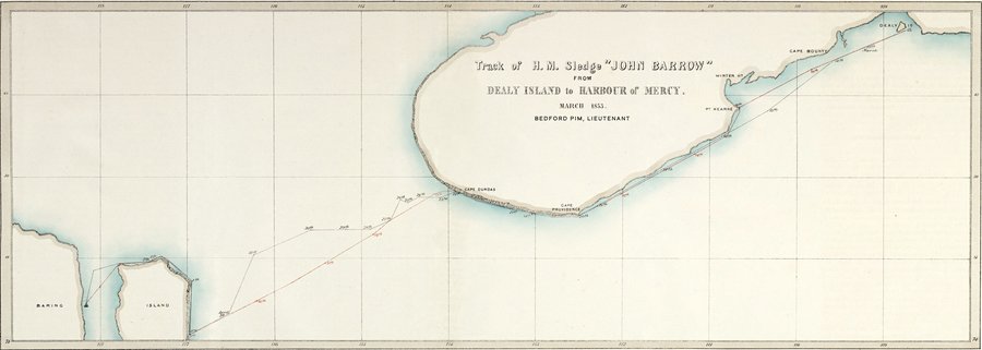
Map showing the route followed by Lieutenant Pim from Dealy Island to reach Mercy Bay and rescue the crew of the Investigator. Further Papers Relative to the Recent Arctic Expeditions in Search of Sir John Franklin and the Crew of H.M.S. “Erebus” and “Terror”, London, 1855. (Credit: Hubert Sagnières Collection)
On March 10, 1853, Bedford Pim, a young lieutenant of the HMS Resolute, left Dealy Island with a small party and set out on a sledge journey of nearly five hundred kilometres (about 310 miles) to the west. Following in Edward Parry’s footsteps, he skirted Melville Island before crossing McClure Strait to Banks Island.
On April 6, 1853, he reached Mercy Bay. His meeting with Robert McClure marked the beginning of the rescue of the sixty-six crew members of the HMS Investigator. Every one of them would survive.
MARCH–JUNE 2026
One hundred and seventy-three years later, Mike Beedell, Bertrand Delapierre and Hubert Sagnières set out to retrace, on skis and in complete self-sufficiency, Bedford Pim’s journey between Dealy Island and Mercy Bay.
For nearly two months, the expedition covered those five hundred kilometres across McClure Strait in order to
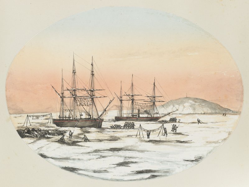
Original watercolour by Émile de Bray depicting Dealy Island and the wintering of the HMS Resolute. Private collection.
For nearly two months, the expedition covered those five hundred kilometres across McClure Strait in order to revisit the principal sites in the history of Arctic exploration: Winter Harbour, Cape Bounty, Parry Rock, Cape Dundas, the old British depots, the cairns, the wintering sites and, at last, Mercy Bay, where the wreck of the HMS Investigator still lies, discovered by Parks Canada in 2010.
The original maps, watercolours and logbooks of Edward Parry, Bedford Pim, Henry Kellett, Leopold McClintock, Robert McClure and the Frenchman Émile de Bray accompanied every stage of the journey. They made it possible to set the accounts of the 19th-century explorers against the observations made in the field in 2026, and to measure what one hundred and seventy-three years had transformed… or left untouched.
Beyond this historical reading, the expedition also brings to light another essential dimension of this territory: that of Inuit occupation. Long before the arrival of the European explorers, these lands were travelled, named and used by the Inuit. The archaeological remains, the traditional routes and the testimonies gathered during the preparation and then the expedition remind us that this history belongs to several peoples and to several ways of seeing one and the same land.
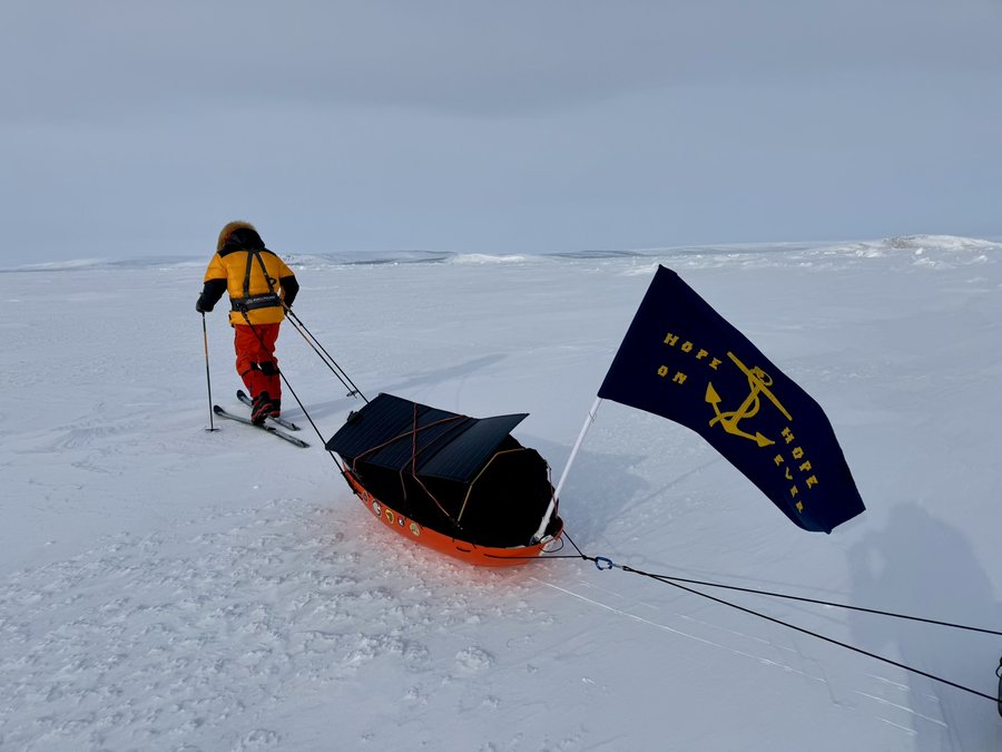
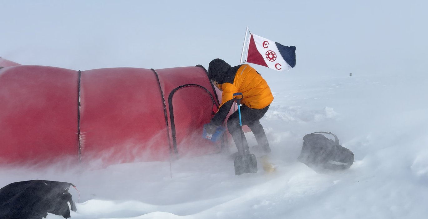
Spring 2026. Hubert hauling a reproduction of the Sledge Flag made by Lady Jane Franklin for Lieutenant Bedford Pim in 1853. Photo credit Bertrand Delapierre.
This expedition did not set out to reproduce a feat, but to carry out a historical investigation in the field. By bringing the 19th-century journals into dialogue with today’s landscapes, it offers a renewed reading of a major route in the history of polar exploration.
One of its main conclusions is that the historic corridor linking Dealy Island to Mercy Bay constitutes a heritage ensemble of exceptional value. The observations made in the field strengthen our proposal to Parks Canada to recognize this route as a Canadian Historical Trail, in order to ensure the protection, promotion and transmission of this unique heritage.
This is the story of two springs, one hundred and seventy-three years apart