April 02, 2026
The sharp smell of dimethyl sulfide filled the air as Dominic Barrington hauled up the pungent net and showed it to the volunteer scientists aboard a rigid inflatable boat bobbing between the icebergs near Ilulissat, Greenland.
“They describe it as the smell of the sea,” he said.
Barrington, an environmental scientist aboard HX Expeditions’ Fridtjof Nansen, was leading a small “science boat” excursion to gather samples and data. The ship was bound for the Northwest Passage, but paused in Ilulissat to explore the UNESCO-designated Icefjord before boarding the small boat to collect data for the Iceberg Ecosystems Project (IceEco).
“It’s a project that is helping support understanding of what's happening in the polar regions in relation to climate change, and with a warmer world, the melting of ice caps and glaciers and that influx of fresh water into the marine environment,” Barrington said.
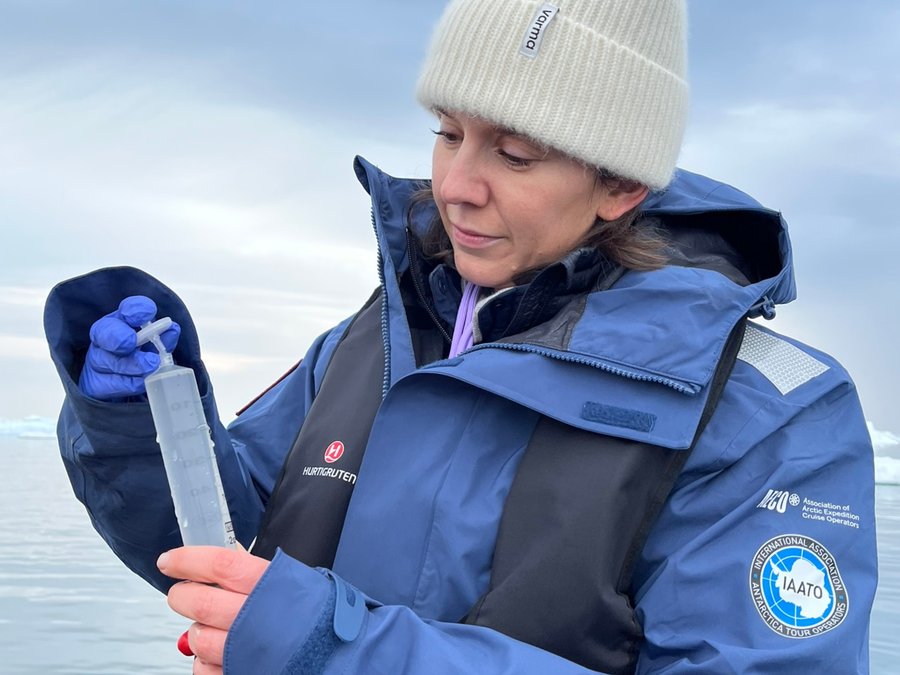
The IceEco project helps deepen understanding of climate change impacts in the polar regions, particularly how melting ice is altering marine ecosystems.(Credit: Kristen Pope)
IceEco is a project by researchers at Scripps Institution of Oceanography at the University of California, San Diego, to study how coastal Greenland ecosystems are impacted by icebergs and meltwater from the Greenland Ice Sheet, and how the melting ice sheet is impacting the food web.
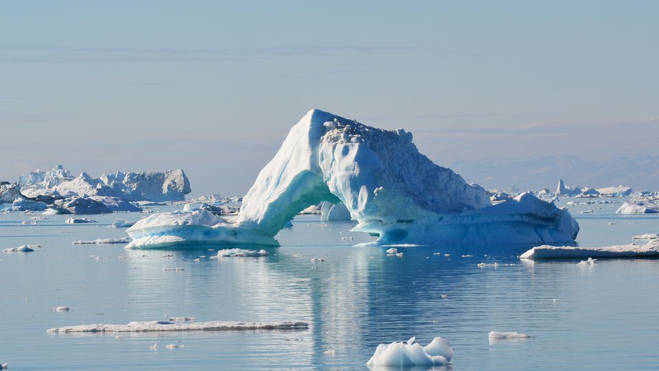
This massive ice sheet is more than 1.6 million square kilometers in size, and it has been losing around 266 billion metric tons per year since 2002, according to NASA. This lost ice ends up in the ocean as calved icebergs and meltwater, contributing to sea level rise.
The composition of glacial icebergs and meltwater can be quite different from that of the ocean. Meltwater is generally colder and less salty than ocean water, while also containing iron, nutrients, and other materials from the ice sheet. This influx of nutrients can boost the phytoplankton that serves as the base of the oceanic food web.
“Icebergs break up the surface ocean layer as they drift,” said Maria Vernet, a Research Biologist at Scripps and co-principal investigator for IceEco. She explained that the melting ice “brings deeper, nutrient-rich water to the surface where there is light and phytoplankton can grow.”
The composition of glacial icebergs and meltwater can be quite different from that of the ocean. (Credit: Kristen Pope)
In turn, the flourishing phytoplankton can benefit other marine organisms, as they are first eaten by zooplankton, followed by small fish, and ultimately nourish the seabirds at the apex of the marine food web. Icebergs also offer an additional benefit to avian life by providing a place to rest.
IceEco researchers are particularly interested in understanding the role icebergs play in the ecosystem. Previous research by Vernet and colleagues focused on the impact of Antarctic icebergs, which they found can impact water up to 19 kilometers away, with meltwater impacts lasting for up to 10 days.
The researchers also found that drifting Antarctic icebergs created a ring of productivity around them as meltwater nutrients boosted phytoplankton nearby, with impacts rippling throughout the food web.
“What the previous findings indicate is that by staying a week or more, the meltwater can help stabilize surface waters and provide a positive environment for phytoplankton growth,” said Vernet.
However, she added, scientists do not expect those findings to be replicated to the same degree in Greenland due to differences in iceberg size and environment, since the Antarctic iceberg studied was massive and in the open ocean.
To learn more about how glacial ice and meltwater impact the ocean in that particular ecosystem, IceEco researchers are developing a remote-sensing model of iceberg meltwater specific to Greenland.
IceEco researchers are building a Greenland-specific model to study how glacial ice and meltwater affect the ocean in that particular ecosystem. (Credit: Kristen Pope)
Using satellite images, researchers will estimate how much chlorophyll-a – which can be used to measure productivity in a body of water – is present, using this phytosynthetic pigment found in phytoplankton to better understand the abundance and concentration of phytoplankton. Satellites can also provide information on iceberg abundance, including the location and size, and observe how much meltwater is being deposited in the ocean because of variances in its optical properties.
Vernet explained that the remote-sensing data will be used to test the hypothesis that icebergs support higher productivity, as evidenced in fjords by higher phytoplankton biomass.
“Basically, the question is, are greener fjords also rich in icebergs?”
To answer this question, the team is creating a Greenland-specific color model to build on the machine learning model researchers used to analyze satellite images of meltwater in Antarctica. Using remote sensing in this way can provide researchers with valuable information over vast areas and significant amounts of time that they wouldn’t otherwise be able to gather. However, to fully utilize the remote-sensing data, researchers need to learn more about how to interpret the satellite images to understand what is actually happening in the field.
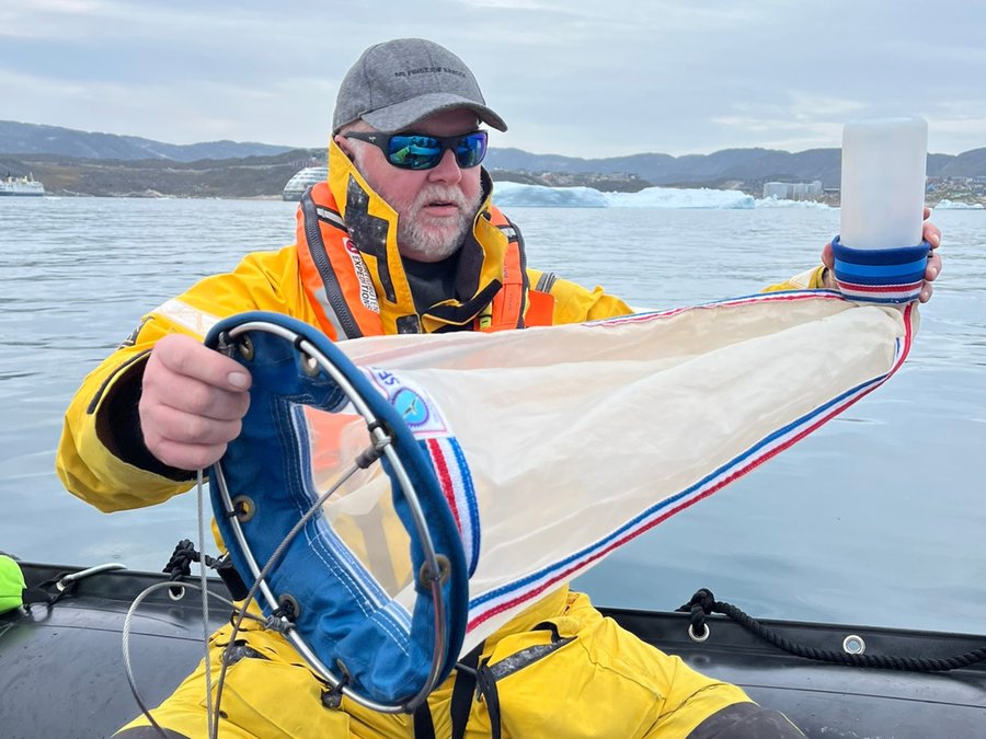
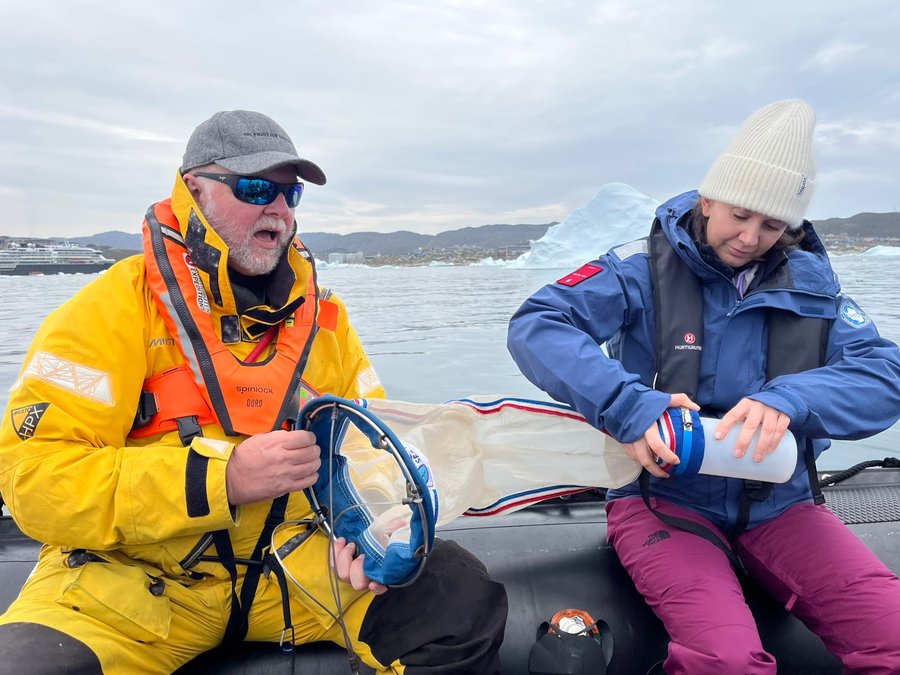
The IceEco volunteer team, led by Barrington, was tasked with collecting on-site measurements needed for ground-truthing. This 2025 outing marked the first of three planned years of fieldwork.
The collected data will help IceEco scientists calibrate their satellite data and learn more about what’s unfolding in Greenland. (Credit: Kristen Pope)
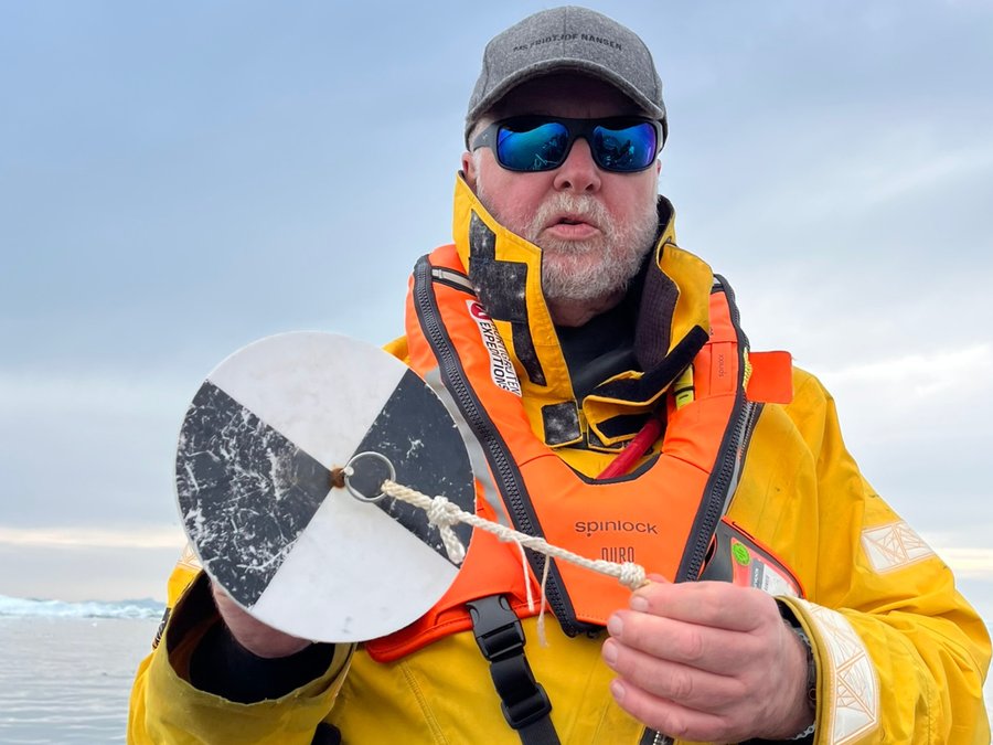
Barrington walked the team through their tools and techniques, teaching them how to collect and record the data. They towed a net to collect phytoplankton, gathered water samples for thorough lab analysis, and dropped a black-and-white Secchi disk into the water to measure its clarity.
Once the disk slipped out of sight, they measured the depth of visibility and reeled it back in. A hydrophone collected underwater sounds, and Barrington took smartphone photos of a grey-colored card to upload to an app to measure the water’s reflectance.
These data will help IceEco scientists calibrate their satellite data and learn more about what’s unfolding in Greenland. The findings will aid them in developing a Greenland-specific model to better understand iceberg ecosystems, with this knowledge benefiting nearby communities.
“Locally, coastal ecosystems support biodiversity, fisheries, tourism, all important economic factors in Greenlandic life,” Vernet said.
However, what happens in Greenland—especially relating to the ice sheet—also has global implications.
“The melting ice cap affects sea level rise worldwide and is affecting the ocean conveyor belt, or how surface currents in the ocean are connected to deep currents,” Vernet said.