February 26, 2026
Before there were maps in the North, Inuit Elders guided younger generations across the Arctic. They passed down traditional place names, rich with meaning and survival knowledge, through stories and landmarks.
Now, the Inuit Heritage Trust (IHT) is working to ensure those names are not lost by restoring them to official maps across Nunavut.
“Place names research that culminates in the names being made official is essential to preserving this tangible source of traditional knowledge for tomorrow’s generations,” said Lynn Peplinski, the Director of Traditional Place Names for the IHT.
Through its Traditional Place Names Program (TPNP), IHT is documenting Inuit place names drawn from oral history and traditional knowledge. The effort is part of a long-term project to reclaim Inuit geographic knowledge and accurately reflect it on modern maps all across the North.
“Our work is based on the principles of respect for the traditional knowledge and wisdom of our Elders,” Peplinski said.
Through its Traditional Place Names Program (TPNP), IHT is documenting Inuit place names drawn from oral history and traditional knowledge. (Credit: Inuit Heritage Trust Incorporated)
The program, based in Iqaluit, has been underway for more than two decades, beginning when Nunavut was first established in 1999. According to the IHT, about 10,000 traditional names need to be added to the most recent maps across the territory.
This has become more important for local families as the Government of Canada has not updated most maps of the North since 2006.
“Thousands of traditional place names have been made official in recent years across Inuit Nunangat,” said Peplinski. “Inuit organizations are also producing unofficial maps with Inuktitut place names to enable the elders’ knowledge to continue to be shared across generations.”
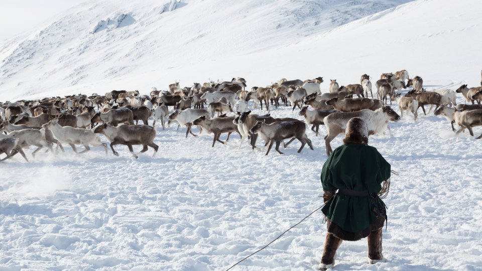
These place names describe bays, lakes, peninsulas, and campsites in ways that convey critical information about travel routes, hunting grounds, hazards, and shelter. Names such as Kangiqsualuk (large bay), Tasiq (lake), Qaiqsu (bedrock), Aulattivik (peninsula where animals were hunted) and Upirngivik (spring camping place) served as practical tools for navigation and survival long before GPS or written charts.
“Inuit, despite the changes they’ve experienced in the past decades, continue to have a strong association with the land,” Peplinski said. “The place names of their ancestors are still helpful about hazards and harbours, currents, routes, good camping areas, fishing lakes and walrus haul-outs.”
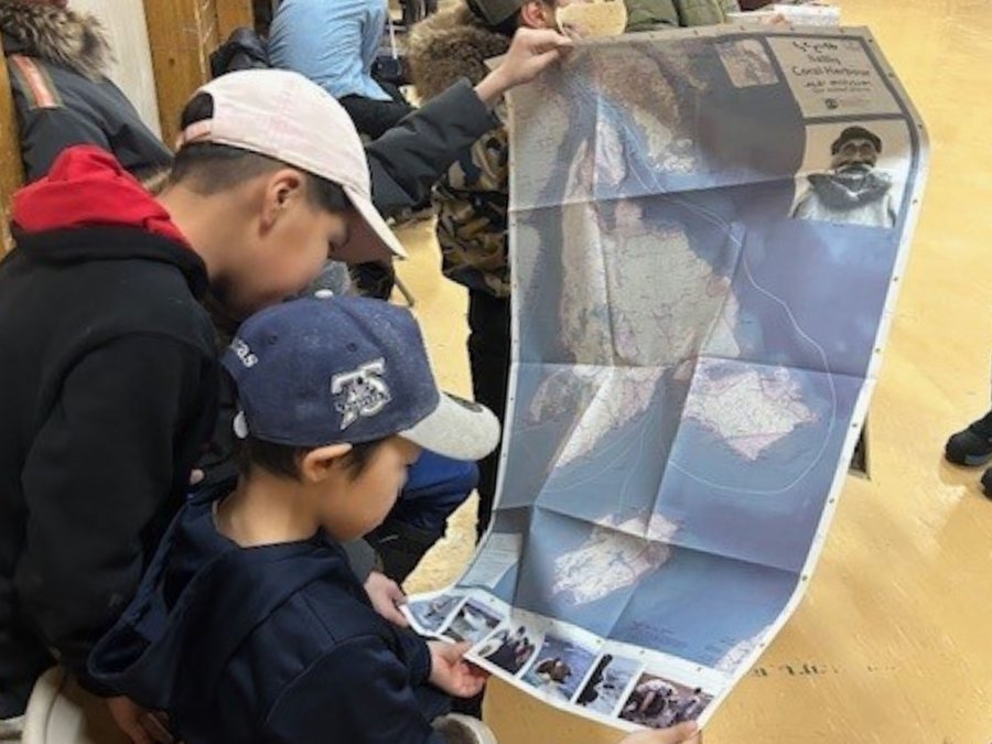
These place names describe bays, lakes, peninsulas, and campsites in ways that convey critical information about travel routes, hunting grounds, hazards, and shelter. (Credit: Inuit Heritage Trust Incorporated)
The knowledge embedded in these names also offers insight into environmental change. Shifts in ice stability, snow conditions, or animal patterns were noted through place-based observations and passed along to future generations, making traditional place names an early record of changing climate conditions.
“All places are in the context of local knowledge,” Peplinski said. “Relevant to other names in the area.”
In Inuktitut, there are up to 350 different names for a single inlet, each describing subtle differences in shape or function. These often small distinctions have helped Inuit survive for centuries.
As more communities work and grow together, the need to travel far and wide to hunt or fish is becoming less of a priority. Elders who grew up travelling extensively on the land are aging, and much of what they know exists only in memory. IHT sees an urgent need to preserve this ancient source of knowledge before it disappears.
“With the passage of time, there are fewer expert knowledge carriers,” Peplinski said. “This is why we need to continue to create and distribute these maps, so all of this information is not lost to memory.”
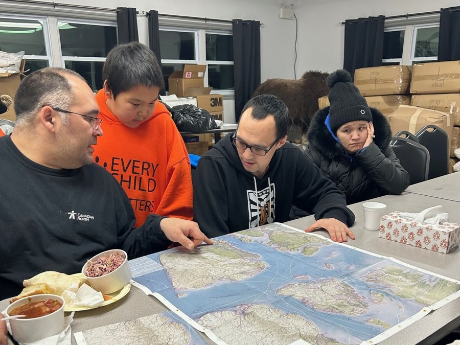
The knowledge embedded in these names also offers insight into environmental change. IHT sees an urgent need to preserve this ancient source of knowledge before it disappears. (Credit: Inuit Heritage Trust Incorporated)
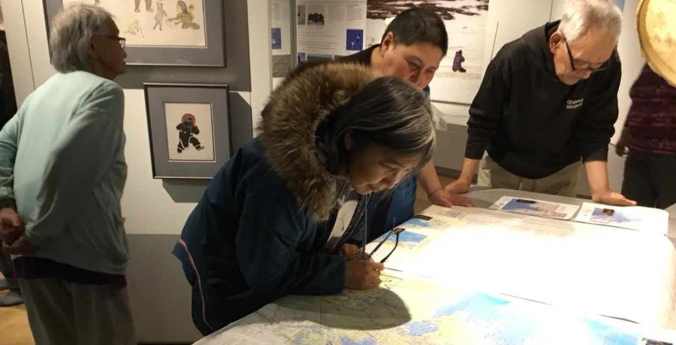
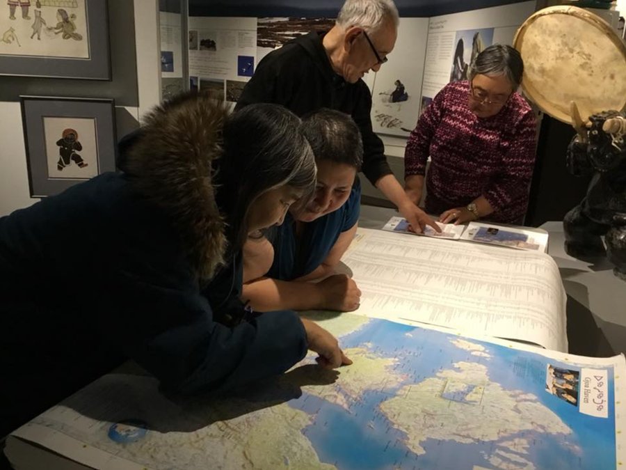
Locals and Elders volunteer from each community to contribute to the knowledge of the area. The maps are updated with rich language and inside information specific to each region. Each piece of information is carefully verified before being added, and errors are corrected in subsequent printings.
Up to 50 names are changed from English to Inuktitut with each update, as more information is recorded.
IHT aims to provide each household in Nunavut with two copies of the updated maps. Making these maps available to everyone provides locals with a shared foundation of traditional knowledge about the land they share.
However, the process of absorbing all this information, making changes and printing out new additions takes time.
The project represents a broad act of reclamation. Many maps across Canada still reflect names assigned by European explorers. This macro view held by those who travelled through these lands, labelling them with arbitrary names that don't convey the same information as traditional names, is not as detailed or relevant to the people who live on the land.
Restoring Inuit place names affirms Indigenous self-determination and allows Inuit become the authors of their own stories.
For more information or to contribute to the master lists of maps in Nunavut, visit https://www.ihti.ca/traditional-place-names