Garfield Giff is the manager of the Aurora Research Institute’s GIS Program in Inuvik, NWT. For the past 20 years his work has focused on the socio-political, socio-economic, and technical issues associated with Geographic Information Systems (GISs) and Spatial Data Infrastructures (SDIs). Arctic Focus producer, Kaitlyn Van De Woestyne, spoke with Garfield to learn more about the program and how it uses drones to collect data in the Canadian Arctic.
KV- Can you explain the project and what it’s all about?
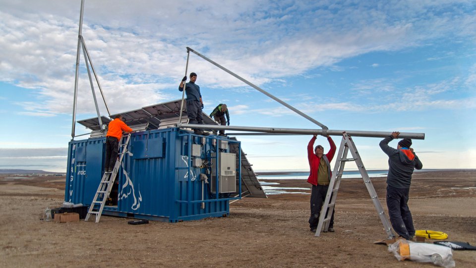
GG- There are several projects that fall under of the umbrella of the Aurora Research Institute GIS Program. The original aim of the project was to grow the GIS capacity in the Northwest Territories and the Western Arctic. We have diversified the program in such a way, that now we are trying to not just grow GIS and remote sensing capacity, but also other technologies associated with GIS and geomatics in general. One of the key features we’ve added to the program is the drone program, which is officially called the A.R.P.A.S Program.
KV – What is your focus with the drone program?
What we do with the drone program is to map and monitor the effects of climate change within the communities. We try to teach community members how to use the technology, so that eventually we can pass it onto them, so they can use it. We try to look at different technologies that are available and see how they best suite the communities. The drone is very useful because there are not a lot of large-scale maps in the North, and to do community monitoring of climate change we need large scale maps. The drone was most cost effective in capturing that kind of data. So, we experimented and found that it could produce the type on results that we wanted, and it was easy and interesting for the community to learn.
KV- What data are the drones capturing to measure the effects of climate change?
GG- It captures the exact location of the features, say if we have a slump, we could capture the position of the slump, the size and shape of the slump, the volume of the earth that has come out of the slump. Then next year we fly the area again and you do the same, and you can see the change in the slumps so you can see if there is a shift in the size and shape in the slump.
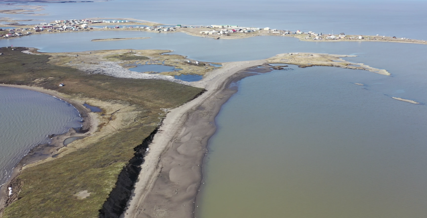
We do that for the coastline as well, in fact there is an Island just off of Tuktoyaktuk that we map and monitor regularly. The coastline there changes on average about 4 meters per year. The island is slowly disappearing, and there are other parts along the coastline of Tuktoyaktuk that are disappearing rapidly.
KV- What other data can you measure with the drones?
GG- It depends of the sensor you have. We just acquired Lidar sensor, which is able to penetrate the snow we are now able to use that to measure snow depth. Prior to having a Lidar, we would go and measure the surface first before the snow fall, then go back again and measure the surface after the snow fall and calculate the difference. We can also use the drone survey to look for the ice breakup, which is important for the community.
KV- Is somebody piloting the drone or are they pre-programed?
GG- Well because it’s in the North, we are affected by a lot of things, we are affected by the satellite coverage because the position of the drone is fixed by GPS, we are also affected by the cold. We have drones that someone can control and have drones that we can program. For monitoring wildlife or monitoring vegetation, you want more flexibility to move along the terrain or follow the wildlife, in that case we use a pilot to operate the drone. For mapping of the slumps and stuff like that, we pre-program the drone and the path it will take.
KV- What type of wildlife and you monitoring?
GG- This summer we teamed up with D.F.O. and we monitored their whale tagging process. We’ve been asked to monitor caribou movements and to monitor the calving areas. It’s kind of tricky, you have to find the right balance between the invasion of their species and just monitoring them from a far. We have to use the drones with the quiet propellers, and we have to fly a certain height above them. So, we do take into consideration the effects we have on the wildlife.
KV- You mentioned that there is not a lot of mapping in the North, why is it so important to be collecting this data?
GG- Because you can’t make a decision without information, and everything had a spatial location, so you need maps. In the North, it’s even more important because the people live on the land, it’s their way of life. The map tells us where everything is, at the certain point in time. With a drone you fly it today you get the information today.
KV- What are your ultimate goals for this project?
GG- The ultimate goal is to have sufficient pilots and sufficient data processors trained in the North. So for any decision that needs to be made these pilots and data processors can collect the data, process the data and inform the decision, that’s the ultimate goal. Then you get people in the North more involved in the research, they know you and better understand what you are doing. They are more susceptible to you coming in and not seeing you as an outsider, but as a partner working with them to help make an informed decision about their community.
*This interview was edited for length.