August 6, 2026
Growing up in Maniitsoq, Greenland, Frederik Fuuja Larsen recalls sitting in his public school classroom and watching his teacher unfurl a retractable ceiling-mounted map in geography class.
The map revealed a massive depiction of Denmark, with Greenland in a tiny corner. Larsen and his classmates spent their school days learning about cities and towns in Denmark and other places, but not those in East or North Greenland.
“This is how we, my generation, grew up with mapping and learning about maps,” Larsen said. “It was about Europe, about Denmark, England, and France, and not about Greenland. But fortunately, that has now changed.”
Larsen is now Deputy Director, Museum Manager, and Curator at the Greenland National Museum & Archives in Nuuk. Last summer, he shared his schoolroom story in his welcome speech to open the museum’s special exhibition, MAPPING NUNAAT - Rethinking Greenlandic Cartographic Heritage.
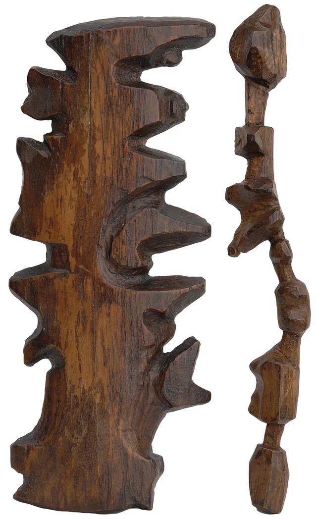
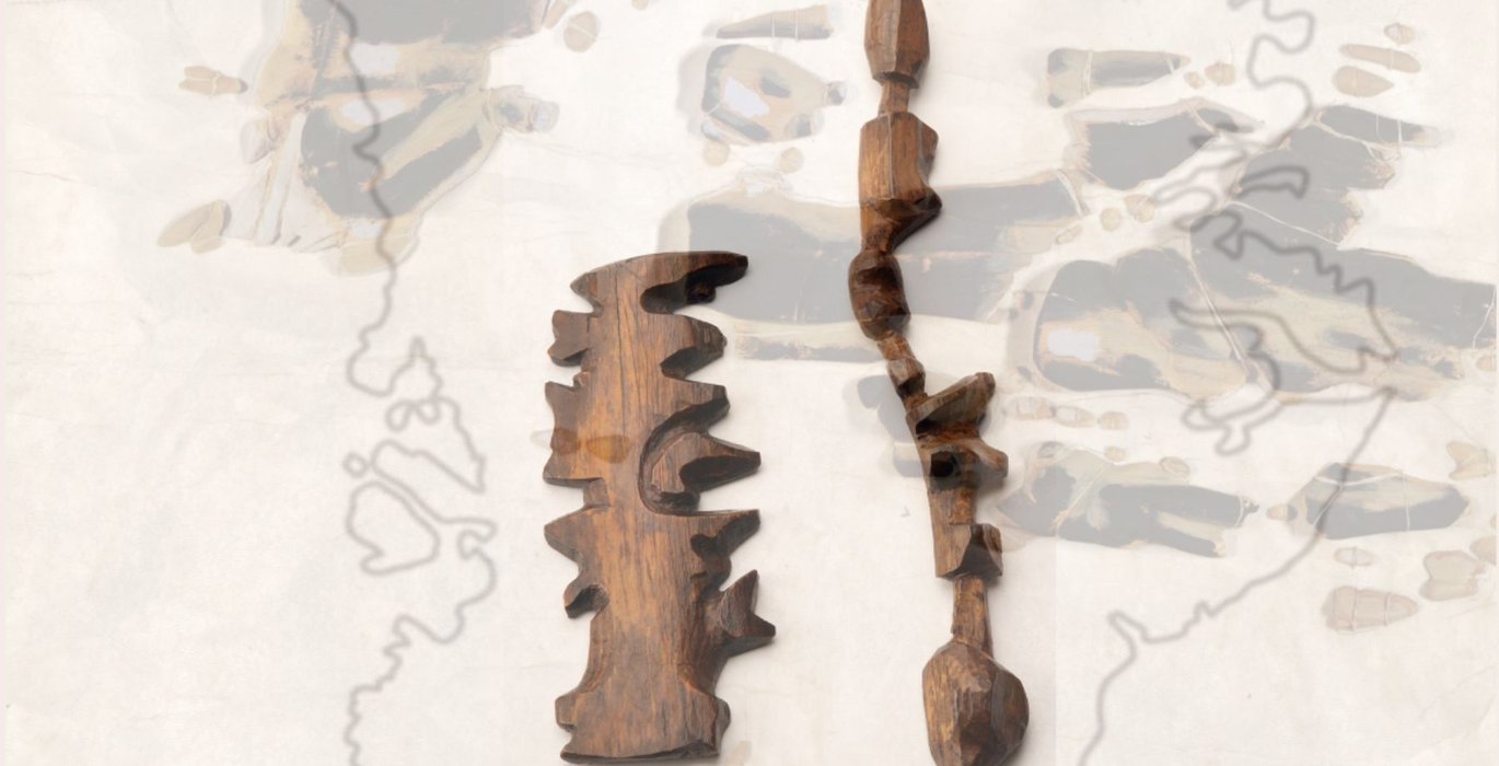
Photograph of Ammassalik maps. (Credit: Greenland National Museum & Archives)
The exhibit, which was on display at the museum in Nuuk from May through September 2025, explores the concepts behind maps, emphasizing that they are not neutral tools or impartial representations. It is now available virtually.
“Maps have shaped how the world is seen—and owned. Maps shape how we understand, claim, and control space,” the exhibit text notes.
The project is a collaboration between Larsen and fellow co-creators Pierre Singaravélou, a professor at Université Paris 1 Panthéon-Sorbonne, and Fabrice Argounès, an assistant professor at Université Rouen Normandie and Université de Liège, along with a broader team of contributors.
Focusing on Greenland and the Arctic, the exhibit explores Western cartography and topics such as colonial renaming, the erasure of Indigenous place names and knowledge, “blank spaces” on maps, and the creation of an illusion of “empty” lands.
“The history of Arctic cartography is also a history of power. For centuries, European maps were shaped by various forms of borealism, presenting Greenland as empty space — terra incognita, a territory to be conquered, named, and claimed for the benefit of Danish colonial power, or of British, French, and American actors,” said Singaravélou and Argounès, in a joint statement to Arctic Focus.
The exhibit, which was on display at the museum in Nuuk from May through September 2025, explores the concepts behind maps, emphasizing that they are not neutral tools or impartial representations. It is now available virtually.
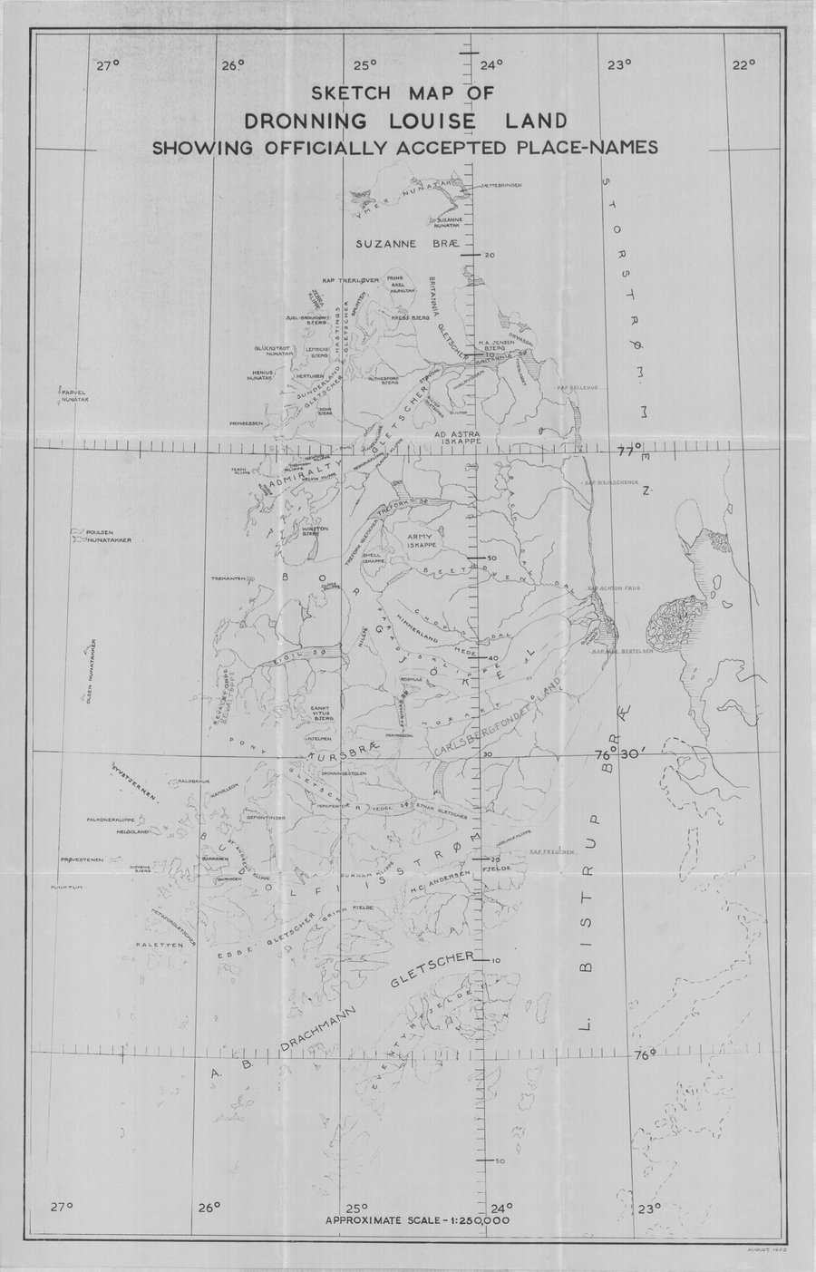
The exhibit explores Western cartography and topics such as colonial renaming, the erasure of Indigenous place names and knowledge. (Credit: Greenland National Museum & Archives)
These naming traditions provide people with tools for navigation and also share key information to help them understand places and travel safely through them. However, in many cases, these meaningful names were replaced by Western names of monarchs or even ship crew members.
“Inuit geographical knowledge, remarkable in its richness and accuracy, was marginalized, rendered invisible, reduced to mere curiosity or exotica, or simply ignored,” said Singaravélou and Argounès. “
While renaming places was common, many maps also depicted vast “blank spaces,” which the exhibit’s authors say can reflect "both ignorance and imperial desire.”
According to the exhibit text, “These cartographic voids depicted lands as empty and unclaimed, ready to be named, explored, and appropriated.”
These map voids also depict European projections of Arctic geography as cold, white, and unsuitable for human habitation. Strategic omissions, such as removing Thule Air Base from depictions of Northern Greenland during the Cold War, also occurred.
“This exhibition aims to restore another history of the region: that of a living, sophisticated Greenlandic cartography, deeply rooted in a relationship to territory that Western scientific tools have long struggled to grasp and acknowledge,” said Singaravélou and Argounès.
MAPPING NUNAAT’s displays include Inuit cartographic items that commonly use skins, driftwood, and other materials, rather than the scrolls or sheets of paper commonly used in Western cartography.
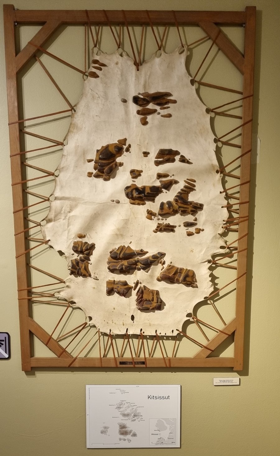
A displayed map made of Seal skin and wood. (Credit: Greenland National Museum & Archives)
The exhibit includes Ammassalik wooden maps, which are now curated by the Greenland National Museum and Archives after being repatriated from the National Museum of Denmark in Copenhagen. These sculpted wood maps are tactile, tracing the outline of Eastern Greenland’s coast. Created in the 1880s by Kunit fra Umivik, they are important items of Greenland’s heritage and pride.
“These objects, which mark their 140th anniversary in 2025, are not exotic curiosities: they are masterpieces of world cartography, combining topographic precision, narrative memory, and oral transmission,” said Singaravélou and Argounès.
The exhibit also includes several alternative cartographies that challenge dominant narratives.
“Maps can be reclaimed as tools of resistance and reappropriation,” Larsen said.
One such map displayed in the exhibition and created by American cartographer Richard Edes Harrison in the 1940s, centers around the North Pole and shows the Arctic and its geopolitical importance.
Another inclusion was a surrealist map with features named “General Electric Co. Ice Cap” and “Pan American Airways Corp Ice Cap,” as well as counterfactual maps showcasing the potential cartography if the Inuit had colonized Europeans.
The exhibit also discusses cultural boundaries and how Inuit communities can transcend national borders, as well as the Atlas of Indigenous Peoples of Canada, which was created with Indigenous Elders and many other stakeholders to prioritize Indigenous knowledge.
Together, the pieces invite viewers to reconsider who maps are made for, whose perspectives they reflect, and how geography can shape power, identity, and belonging.