Navigating the polar regions is a challenge unlike any other, with unpredictable ice, harsh conditions, and sparse data. IcySea, an app by the team at Drift+Noise Polar Services, was conceived to provide near real-time information on sea ice to support safety, efficiency, and sustainability for ships operating in Arctic and Antarctic waters.
Jakob Bünger, Drift+Noise’s Research and Operational Field Support specialist, spoke with Arctic Focus aboard the icebreaker Le Commandant Charcot to discuss ice navigation, satellite data integration and bridging the gap between technology and users.
Grace: Ok so just to get us started – what is a two to three sentence description of what IcySea is?
Jakob: IcySea is a map-based interface providing near real-time sea ice information to basically anyone who's interested in these here and now. It is not only useful for strategic planning but also specifically for tactical movements when you're in the ice or at its edge, finding ways to help you be more efficient, save fuel, and increase the safety of your ship.
Grace: Ok great, let’s dive in – can you tell me a bit about your role at Drift+Noise?
Jakob: I have a background in science specifically in sea ice physics. At Drift+Noise we developed IcySea, which is an app that provides sea ice information data to ships navigating ice. My role is that I bridge the gap between the developers that really know their way around the programming versus the users – the ship workers that are on the bridge – that need to make use of the data that we provide them. I am here on this ship to serve as the link between the knowledge of the team onshore and the navigators. I am both teaching the Bridge how to use the app but also learning what other things or new improvements they would like to see in the interface. Ultimately, we want the app to be the one-stop shop for ice information data. There is actually a lot of really good sea ice information and data out there.
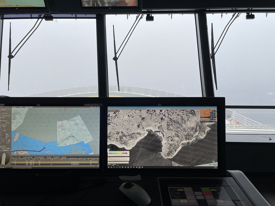
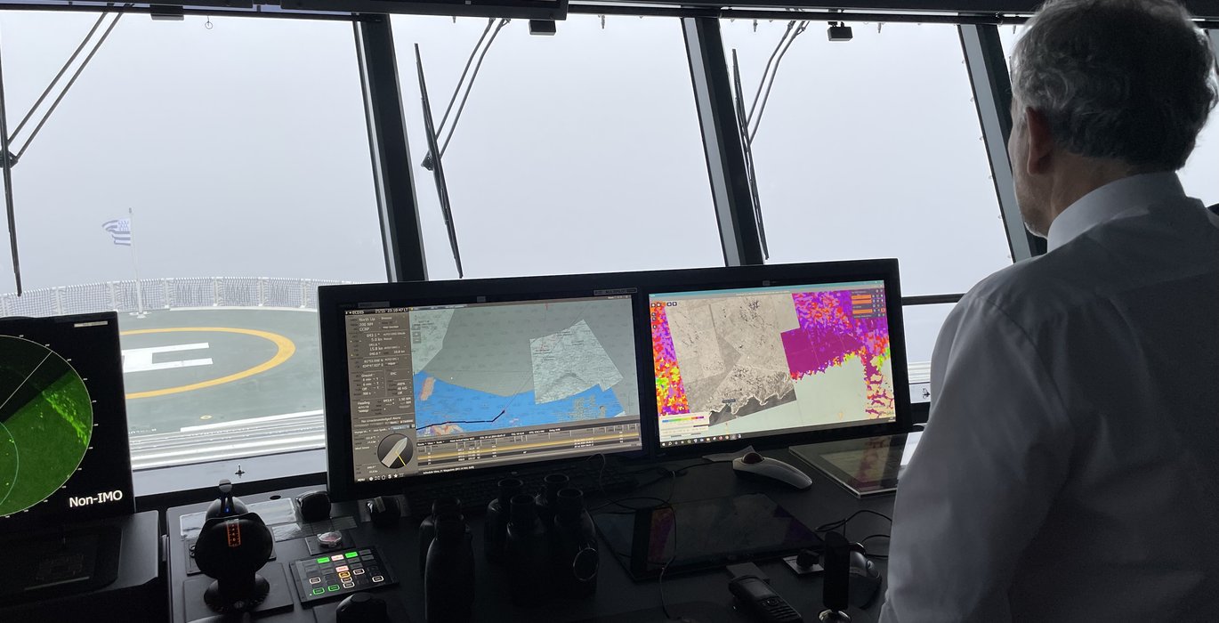
IcySea is a map-based interface providing near real-time sea ice information. (Photo: Grace Cordsen)
Grace: Great – now do you mind describing a bit more about what the app is and what it does?
Jakob: So, it started with us being on ships just doing our academic research and then being asked to help with the navigation by integrating satellite data. Usually, or back in the day, on these ships that were navigating through ice you would have an empty navigation screen where you could only see your own position, other ships’ positions, the land and that's about it.
For a team that is navigating through Arctic waters, they face this pretty big issue of having no precise idea of what the ice looks like, where it is, and where it's moving. So, starting with that issue in mind, IcySea is a mapping interface where you can upload your own position into the app and then you can download various data sets that can help you navigate around the Arctic and Antarctic ice more easily and efficiently.
The various layers of ice information found in the IcySea app are all very different, but when combined, really get a comprehensive picture of what's going on with sea ice movement, change, and formation.
Grace: What does the app help the ships avoid?
Jakob: That really depends on what kind of ship you work on, for example we are on the Le Commandant Charcot which is an icebreaking vessel. For the Charcot, it is really all about avoiding extra costs.They can break ice, but the high-resolution satellite imagery that we provide makes it so that they are able to find the paths of least resistance or less difficult ones through the ice. It is saving a lot of fuel. Ultimately, that is the goal for all ships, but they have different capabilities and therefore varying demands. Some need to avoid ice altogether and IcySea can help with that too.
Grace: What were some of the challenges in the development of the app?
Jakob: The biggest initial challenge was that usually when you move too far south, or north, the satellite connection gets bad. There used to be basically no internet; you could use iridium satellite connections but those were also bad. We developed IcySea by looking at huge gigabyte-sized images and then processed them into kilobyte or megabyte size so that you can still get the data you want for the specific area you are in, but you don’t have to download all the data. Now with Starlink, everything is starting to get better and faster, but it is still a struggle for navigators in polar waters from time to time.
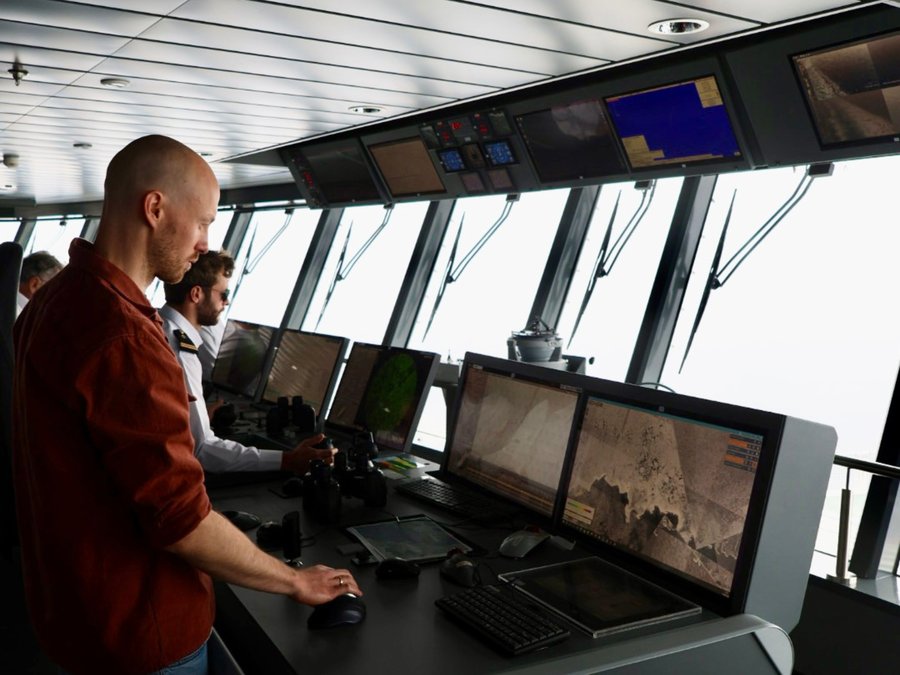
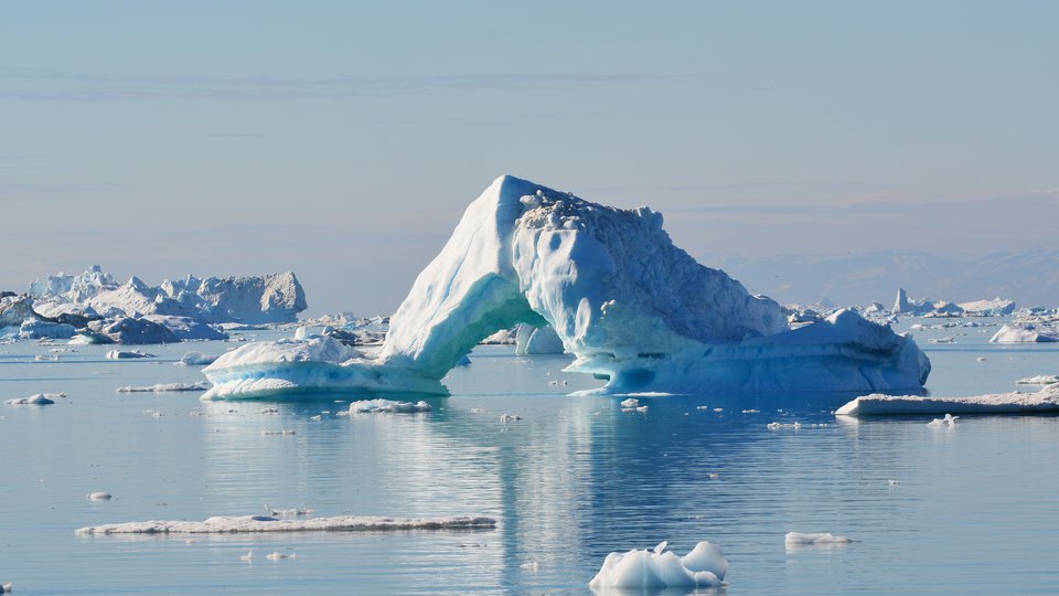
For a team that is navigating through Arctic waters, they face this pretty big issue of having no precise idea of what the ice looks like, where it is, and where it's moving. (Photo: Grace Cordsen)
Grace: Wasn’t there also a major gap in data around the North Pole?
Jakob: You’re right, so most data is based on satellite data and the orbits of these satellites are set up in a way that when they orbit the earth, they capture the most relevant areas.
However, in following these paths around the globe they must leave some areas blank, and those areas are right around the poles. This is known as the “pole hole.” For a ship going to the North Pole, like Charcot, this means that they have to rely on lower spatial resolution products in their approach.
With Charcot’s capabilities that is certainly possible, but adds a level of uncertainty that every operator would want to avoid if possible. So, we at Drift+Noise continuously look at the new developments in satellite data and sea ice products to make sure IcySea provides the most useful products for the whole range of interested parties in the polar regions.
For example, IcySea uses data from the European Space Agency’s Sentinel-1 radar satellite. Radar satellite images are the highest-resolution products available for navigation. Those images even allow you to see the ship itself on your image. ESA used to have two Sentinel-1 satellites circling the earth but recently one broke down so they have been saving energy to have their remaining satellite last as long as possible. Unfortunately, that meant limiting the satellite recording time and excluding pretty much the entire area north of 82° N . So in addition to the “pole hole”, almost the entire area relevant for Charcot was not covered with vital radar satellite images anymore.
Grace: Woah, the area north of 82 is a lot of ground, no?
Jakob: Yeah, I mean for sure. For a ship like Charcot, it is bad because the most useful data set for finding lower resistance areas is not available and the team has to use lower-resolution products to find suitable routes through the ice. So, we went ahead and looked for alternatives to include in IcySea and found the Canadian RADARSAT Constellation Mission (RCM). That group of satellites works in a similar way as Sentinel-1 and provides high-resolution radar images until the North Pole and almost daily, thankfully. So, for this ship for example, thanks to the Canadians, we got to see a satellite image of the North Pole before we even got there. There is no other radar satellite data available at the North Pole at the moment.
Grace: Do you have any other favorite use cases of IcySea beyond the icebreaker we are currently on? I know you had the privilege of being on the Endurance 22 expedition which went to Antarctica to find the wreck of Shackleton’s Endurance in 2022. What was it like being on that incredible expedition?
Jakob: That one was special. I was there on the ship to do research initially, as I was finishing my post-doc at the Alfred Wegener Institute, Helmholtz Centre for Polar and Marine Research (AWI) before joining Drift+Noise and it really ended up being a fantastic opportunity to also develop IcySea.
So I would do my ice research and field work on the ice during the daytime and then in the evening and at night would sit with the team and help with the navigation of the ship within the Endurance search area. Being part of that huge team and the massive amounts of planning that went into that journey was really an incredible experience. The crew really took what the Drift+Noise team had to offer and ran with it – it was so special to play a role in the whole voyage in some way.
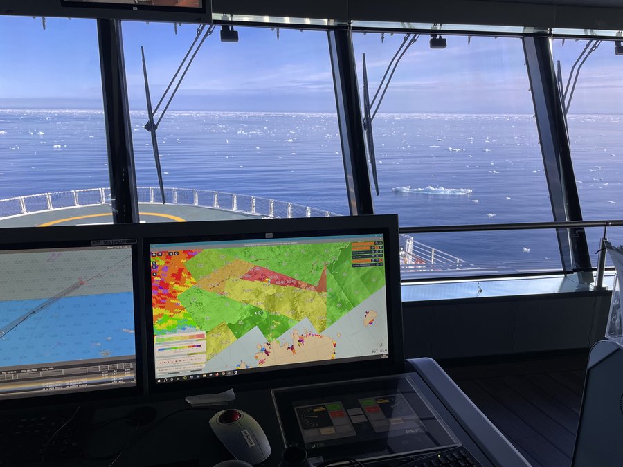
Information found in the IcySea app are all very different, but when combined, really get a comprehensive picture of what's going on with sea ice movement, change, and formation. (Photo: Grace Cordsen)
Grace: What are the long-term goals for IcySea? What are your ideas for the future development of the app?
Jakob: We are always trying to stay up to date with the research which is constantly developing. New products are also always coming out and we try to incorporate them into IcySea as soon as we can.
When it comes to developing the app, there is still so, so much to do. For example, when it comes to ice classification, we want to go beyond the typical ice charts one sees and we want to develop and include high-resolution, color-coded mapping that will tell you exactly what you are seeing – for example telling you that a specific point is a multiyear ice floe with X thickness, etc.
Another idea in development is automatic route suggestions for ships through the ice based on ship and ice characteristics.
Importantly for us, overall coverage and temporal resolution of ice imagery is getting better and better. On this trip we are on now, we got a new satellite image every day. This is good, but ice is dynamic, it moves all the time and in a very unpredictable way. Even just having the knowledge of knowing exactly where you are on a satellite image makes a huge difference – we are trying to make it possible that the ship’s radar is always aligned with the satellite imagery.
This way the navigators don’t just see the immediate vicinity of the ship on their radar but know about the ice situation in a radius of 100 km and more around the ship: Where is open water? Where is the ice edge? Where are big ice floes we want to avoid? All of this information is available and as you can imagine it makes a huge difference for planning and navigating in these challenging waters. It is like knowing where you are on a map of a city – but it is a moving city of ice covering the sea.
Grace: Thinking more about climate, is there anything that developing IcySea has revealed to you in terms of climate change or even just simply the importance of the polar regions?
Jakob: I wouldn’t say IcySea has been what has really made me realize those things, but what truly has is simply just interactions with individuals who are deeply passionate about the polar regions. Interest in the polar regions is growing massively, so more people are looking into possibilities of going to the Arctic. I think most people still underestimate climate change. It is a transition that is not happening immediately, but slowly and in a very variable way.
One thing that has been highly discussed lately is the idea of opening the Arctic to shipping even more. To me, these discussions can be dangerous and short-sighted because there will still be years where there's a lot of ice. What this means is that people are going to start going to the Arctic expecting ice-free conditions, but that is not necessarily the case every year. Mentalities like this will simply create more chances for accidents from people who are not accustomed to polar conditions. People should be prepared with as much data and information as possible and expect the unexpected in this highly unpredictable part of the world. If anything happens to you in the Arctic, help is still far far away…climate change won’t change that.