Every drop of water counts in northeastern Alaska’s Arctic National Wildlife Refuge (ANWR). Water is scarce in the area, and a layer of continuous permafrost creates an impenetrable barrier making water availability even more challenging.
The vast roadless area, around the size of South Carolina at 19 million acres, has incredible ecological diversity and is home to resident and migratory species, including massive herds of caribou, three species of bears—black, brown, and polar—wolves, Dall sheep, muskox, wolverines, and more than 200 bird species.
It is the traditional homeland of the Iñupiat and Gwichʼin people, and the land is utilized for everything from subsistence to recreation. Additionally, it is known as the proposed site of controversial oil and gas development. Each of these uses—from humans living on the land, to wildlife, to oil and gas development—requires water.
In many ecosystems, surface water can easily soak into the earth and connect with groundwater reservoirs. However, ANWR is located in a region with continuous permafrost, meaning frozen ground that sits below the surface. This layer can be up to several hundred meters thick, creating an impenetrable barrier that prevents surface water and groundwater from connecting.
“If we find those things in water coming out of these springs, we know that that water had fallen as rain and infiltrated into the subsurface sometime in that shorter 50 year or so window.”
Scientists wanted to learn more about the area’s water resources, including the source of surface water and how long it remained in the area, so U.S. Geological Survey research hydrologist Josh Koch and colleagues conducted a study to learn more about the area’s hydrology and how it could change as the climate warms. They published their findings earlier this year.
The researchers focused on two potential hypotheses. One of these hypotheses was that groundwater could be moving through deep aquifers located below the permafrost layer. The other hypothesis indicated that springs and “aufeis fields” (which are large sheets of ice that form after groundwater pools at the surface and freezes) could be supplied by much shallower “supra permafrost” aquifers that are located in the ground above the frozen layer.
“There’s been some question about just how deep are the aquifers in this region,” Koch says. “Is there water coming from beneath the permafrost? Is it only from above the permafrost? In general, the water resources are very limited because we have this frozen ground.”
If the researchers found evidence water came from the deeper aquifers, this could show it was possible the water connected to a large regional aquifer. However, if they confirmed the water was from shallower, local sources, it could indicate that less water could be available in the region, making the area particularly susceptible to climate-related fluctuations and extreme weather events.
The Sadlerochit Spring is one of a handful of small springs that provides liquid water to the North Slope of Alaska year round. (Photo: Joshua Koch, U.S. Geological Survey)
Climate change is altering ecosystems around the globe, particularly in the Arctic, which is warming nearly four times as fast as the rest of the world. Arctic areas like ANWR are facing decreasing sea ice, changing precipitation regimes, vegetation growth, and other climate-related factors that are changing the area’s hydrology, impacting everything from runoff, to surface water discharge, to groundwater.
Collecting samples from the source
Using helicopters, the researchers flew to far-flung sites and field camps, collecting samples from springs, streams, and rivers. When sampling a spring, they would generally try to go as close to the source as possible, while stream sampling often called for finding a representative area that was well-mixed. Samples were collected in April, before the snow melted, as well as during the summer.
Analyzing the chemistry of each sample, the scientists used age tracers to learn about the water’s age and source, while also collecting a variety of measurements, like water temperature, pH, acidity, and salt content. These clues will help them learn more about the area’s hydrology, and show how it might change as permafrost continues to melt due to climate change.
“Saltiness, pH, and dissolved oxygen can give us some clues as to where the water has been,” Koch says. “The streams and rivers integrate that signature, and so looking at the chemistry there helps us trace the water back to where it’s coming from.”
He says there are many age tracers they could use, but since they were particularly interested in learning about water that has only been in the ground for short periods of time, they looked at concentrations of chlorofluorocarbons and tritium, which have been elevated in the atmosphere by human activity in recent decades.
“If we find those things in water coming out of these springs, we know that that water had fallen as rain and infiltrated into the subsurface sometime in that shorter 50 year or so window,” Koch explains.
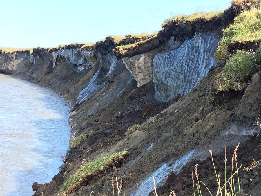
Ice-rich permafrost bluffs on the bank of the Canning River, Alaska. (Photo: Joshua Koch / U.S. Geological Survey)
By studying these tracers, the researchers learned most of the samples they collected were from water that was less than 50 years old, from relatively recent rain and snowmelt, rather than deep groundwater sources. However, one storm sample included water that was around 11,000 years old, which the researchers believe could have been the result of a hydrologic pulse from the storm, which may have forced water through the permeable and impermeable layers.
The researchers also examined “aufeis fields” which are large sheets of ice that form after groundwater pools at the surface and freezes. When the weather warms, these ice fields slowly melt. The scientists used remote sensing to study the size of aufeis fields from 1986 to 2022, finding their size to be strongly correlated to summer temperatures from the year before.
“We found the aufeis size in a given year could be pretty well explained by conditions in the last few years,” Koch says. “[That implies] that how much water was reaching these aufeis fields is dependent on just the last few years. In some cases, we’ve seen these aufeis fields are growing dramatically. Some are shrinking over this decadal time period, but others are growing.”
As they analyzed the water samples, scientists found that much of the water utilized shallow paths, located above the layer of frozen permafrost. Since they don’t believe much of this water connects to deeper, wider-scale aquifers, this indicates that the area could be very sensitive to climate change and hydrologic changes.
While the researchers did not find significant evidence showing the shallow water was connected to deep regional aquifers, they did note that as the climate continues to warm, resulting in additional permafrost thawing, it is possible that this could change the area’s hydrology.
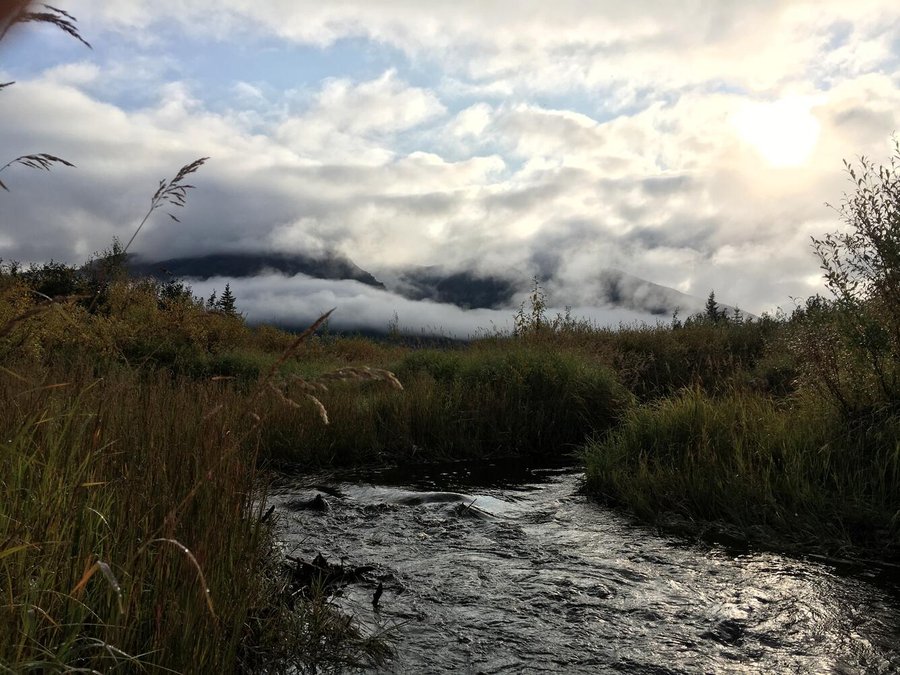
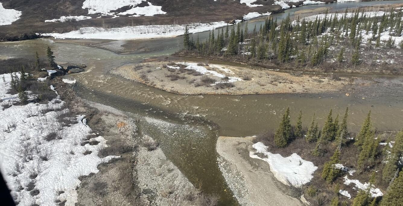
A misty morning in the headwaters of the Akillik River, Alaska. (Photo: Joshua Koch / Alaska Science Center)
As permafrost thaws, shallow aquifers beneath the surface could grow deeper, and unfrozen areas called taliks could form. This could potentially provide greater hydrological connectivity and additional resilience in the ecosystem, but it could also create a number of problems. With warming, the flow of shallow groundwater could increase, which could make it easier for any number of human-caused pollutants to quickly spread through groundwater, and move rapidly through the environment.
“One other implication [of] finding that the subsurface flow paths are shallow and short means that any sort of contamination that occurs in this environment from surface activities could lead to contamination of surface waters in relatively short timescales,” Koch says.
As researchers find answers to some questions, others remain, and they are looking to learn more about how the area is connected hydrologically.
“I think there are some remaining questions,” Koch says. “One great thing about this type of approach that we use looking at this water chemistry is that we’re integrating the signal from the whole landscape, but the downside is that we’re left with questions about what exactly that geometry and structure looks like. So I think there’s work to be done there to dig into that further.”